Geo Imaging
Advertisement
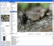
Geomatica FreeView v.9. 1. 2005
Geomatica FreeView is a flexible data viewing tool supporting over 100 raster and vector formats for loading, viewing, selection, and enhancement. FreeView is useful for any geospatial data viewing application, and is freely distributable.
Advertisement
Abylon EXIF-CLEANER v.2014
The software abylon EXIF CLEANER show an overview of additional file information from JPG-/JPEG-pictures and deletes them with one click. For the Internet it is better to remove these personal fingerprints.
Imaging Express
A low cost image viewer and editor specially designed to handle document imaging for Windows XP, with the ability to read and save multi-page scanned documents in TIFF or PDF, supports over 30 other formats. Reading and adding Kodak Imaging compatible
GdPicture Pro Imaging SDK
GdPicture Pro Imaging SDK is a full featured Imaging Toolkit to view, create, acquire, edit and print bitmap and vectorial image. It supports many image formats like TIFF, GIF, JPEG, PNG, WMF, PDF, PCX, PNM, J2K, HDR, PSD, TGA, JNG, EXR, SGI, PBM,
Tape Imaging Software
Tape Imaging Software for creation of dumps from tape devices. Supports all tape drives including SCSI, ATA/IDE USB, eSata/SATA. All formats including LTO, AIT, DLT, SDLT, DAT, Travan, etc, etc. Demo available to see if it can read your tape drive. Ideal
GdPicture Light Imaging Toolkit Site ed.
GdPicture Light Imaging SDK - Site License is an ActiveX component to view, acquire, create, edit, print, convert, enhance, and compose bitmap or vectorial image. GdPicture Light OCX supports image formats like tiff, tif, jpeg, jpg, png, pdf, ico, wmf,
Geo Data German Admin v.15.00
The database contain geodata of the Federal Republic of Germany with geo referenced towns, municipalities, town quarters, administrative units, postal codes, telephone preselections, nature areas, landscapes, climatic zones for proximity searches ec.
Vixelsoft Imaging Express v.1. 4. 2005
Imaging Express 1.4 is a specially designed software for handling Windows imaging documents as well as Kodak imaging compatible files.
LimitState:GEO v.2.0.6
LimitState:GEO is the revolutionary geotechnical stability analysis software that can be used to rapidly determine the critical failure mechanism and margin of safety for any type of problem, including those involving: * slope stability * retain
Vimas Imaging SDK v.5.0
Vimas Imaging SDK can be effectively used in Win32 and .
SmartDeploy Imaging Component v.2.1.0.0
The SmartDeploy Imaging Component (SmartWIM) provides programmatic access to the Windows Imaging File Format (WIM), a file-based volume imaging solution developed by Microsoft to help optimize the deployment of Windows.